In the depths of Armenia...
In our previous daily routes we were able to trace some info about them but for today’s route we found....completely nothing, not even a single photo from Google Earth...! Started at 10 pm with a high spirit and mood for exploring new places heading towards the town of Kapan, 70km away. Road to Kaplan passes via a remarkable canyon among a rich vegetation, very similar with the one in Nagorno-Karabakh. As higher as the altitude reaches, vegetation becomes denser and at some occasions trees are so high that the sun is hidden from us.
Its the first time that we see lorries with Iranian plates as this particular road leads to the borders of Iran. Most probably the reasons of the bad road conditions are due to the usage of heavy lorries and high altitude. Really is fascinating thinking that such importance road can be in such a bad condition. At some point, the man-made lake of Artsvanik appears ahead of us, its waters with bluish-greenish colours provide us with a great view. A stop for photo shooting is a must and also to simply enjoy the stunning view.
A bit further a surprise is waiting us. Just before the village of Syunik, road works are in progress. Glue is applied just before applying tar so the road is closed. The funny thing is that they applied glue in both lanes so both lanes were closed. They informed us by hand signals to return back a few meters were a man was standing with a red flag, this man just a few moments ago gave us the permission to cross this road.
As soon as we enter the diverted narrow road, the road becomes a dirt road – to be more realistic – this narrow road was just an alley crossing the fields. The «road» conditions become worst and worst as distance is covered, at some point road surface gets like powder and moving our motorcycles in such conditions is like dancing Greek folk dances. This powder kind of road has 2 lanes which is also used by lorries. A thin layer of dust is raised like a cloud which limits our visibility to almost a few meters ahead, we couldn’t see even the proceeding motorcycle. Thank god we got away from this difficult moment without any falls or injuries.
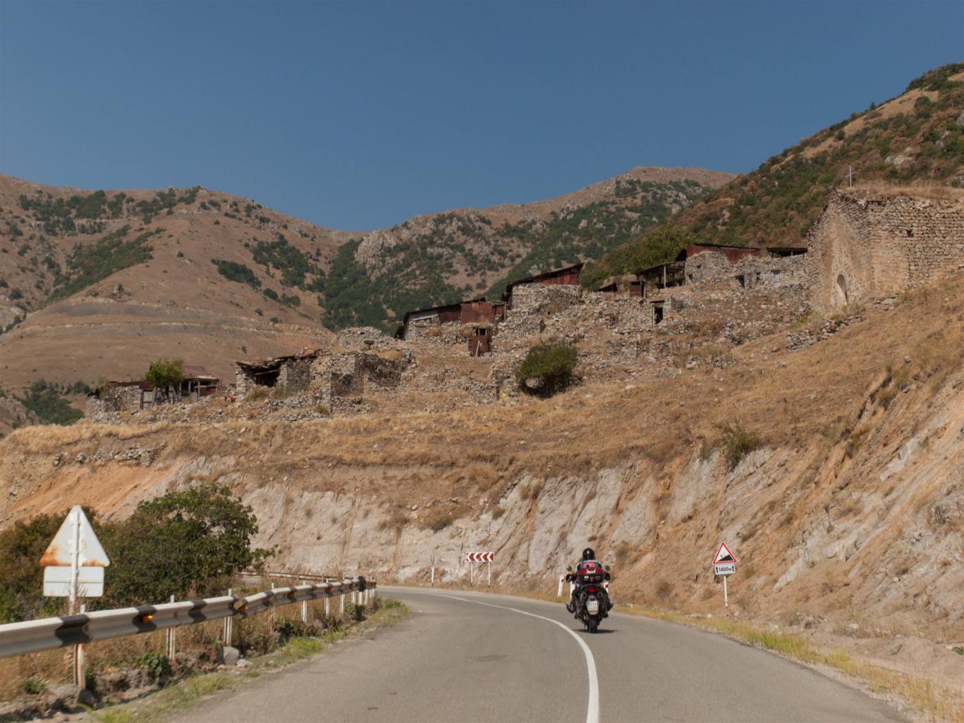
Road works end at Syunik, at the junction which can lead to the main road towards Kapan. Kapan, a little town builded inside a gorge, this is obvious when you take the road Kadzharan – Meghri. The route is gaining altitude within a winding road with many open hairpins. The town view from up here is amazing, not for its architecture point of view but from its location that lies in the gorge.
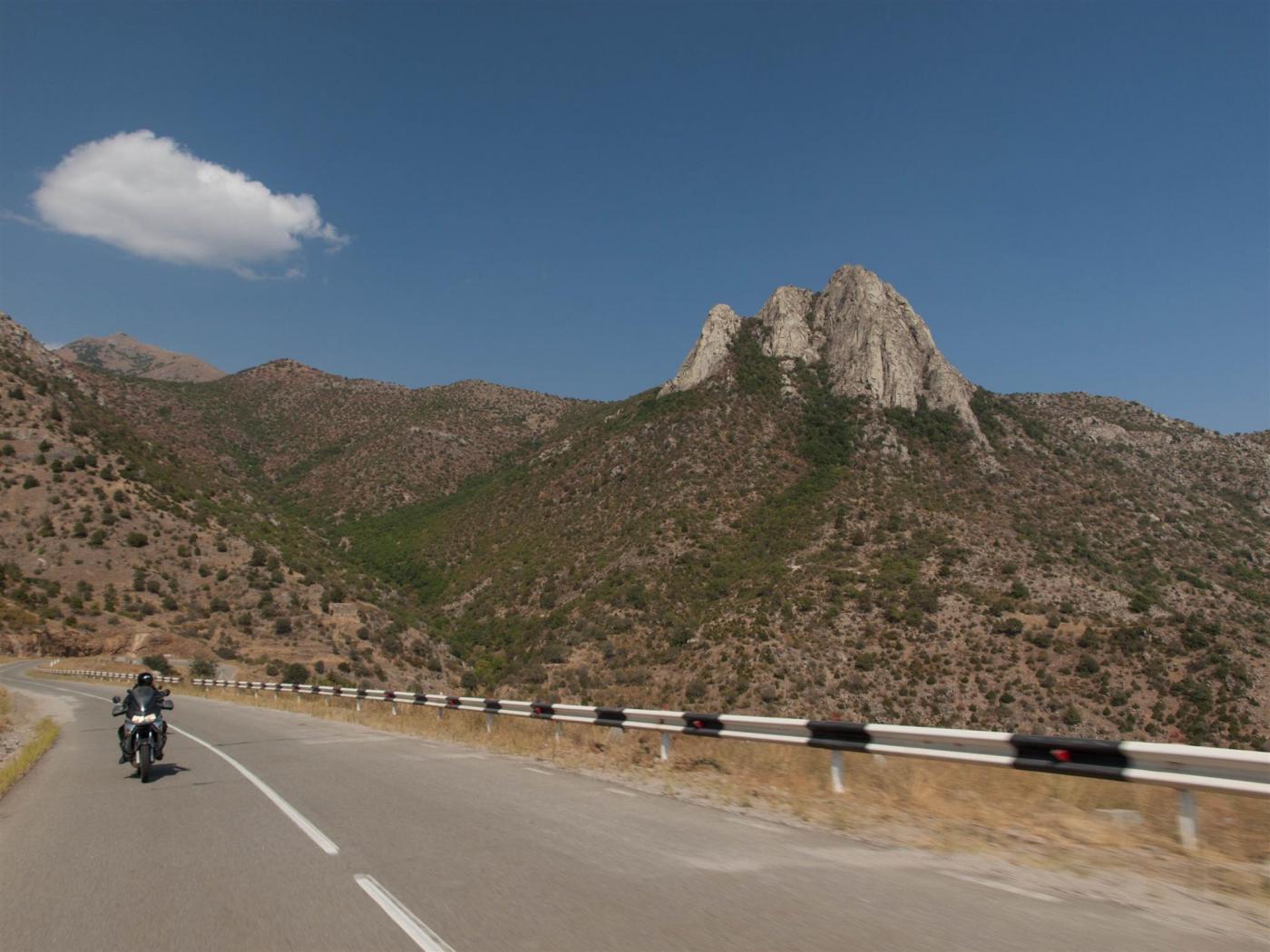
As we are riding, scenery becomes really spectacular. We are surrounded by some rocky very high hills which give us the impression that they reach the sky above. Vegetation is less, a treeless scenery is our view due to the high elevation, grass is mostly covering these rocky hills. But what fascinate us are the curt cuts of their peaks giving us the illusion that they are even higher, perhaps the lack of plateaus is creating this illusion.
We covered 30 km and we are now at Meghri pass at the altitude of 2535 m and the view remains stunning. A break is needed to enjoy the landscape and take some photos. After the photo taking, a descend began and after a few kilometers further we enter the national park of the region. A sign with a wild goat in it is marking our entrance to the national park, vegetation goes to very dense with lots of high trees. Along the road, fast flowing waters of river Aras are running.
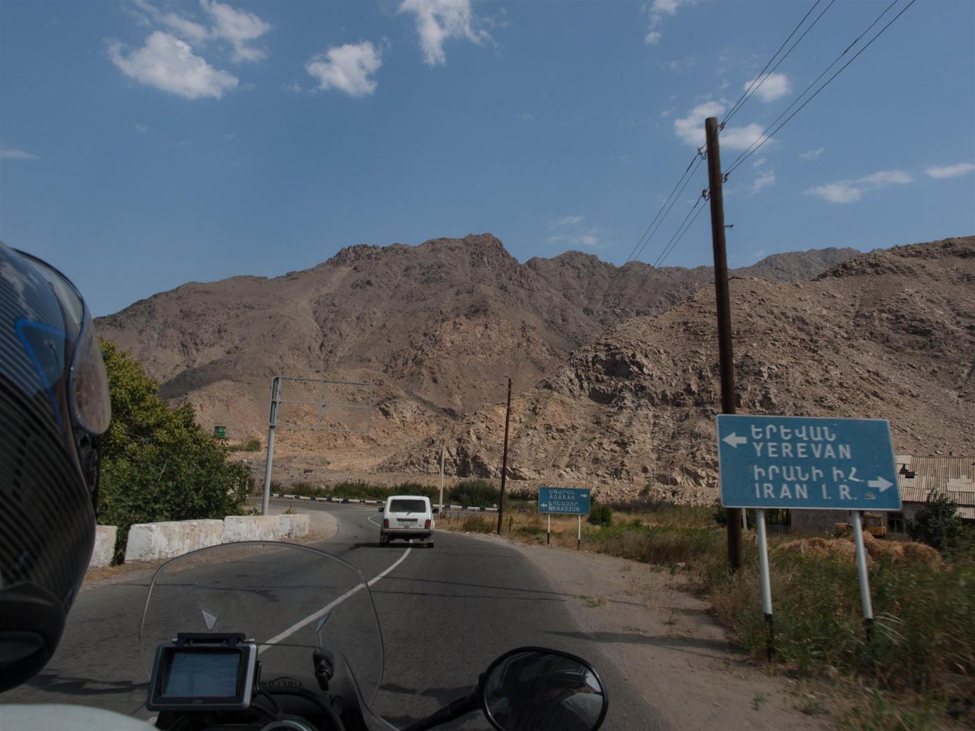
The tiny town of Meghri is amphitheatrically builded on a hill. A half ruined church dominates the view giving an extra touch to this tiny town which traces of decline are seen easily. All these blend perfectly with the remainder environment that has become dry and inhospitable. After Meghri we reach a junction, taking the right turn leads to the borders of Armenia – Iran, left turn goes side by side with river Aras – the physical border of these 2 countries.
In my rear mirrors the last kilometers another motorcycle is added. A GS with an Italian guy which is heading towards Iran. Exchanging greetings and saluting him for happy rides with a small feeling of envy... From that point and further scenery makes us looking at it with great intense. Around us high rocky hills arise with no vegetation and the rocky scenery creating a feeling that you are in a desert. Scenery is giving us an illusion that we entered another country, that we are in neighboring Iran which many of us dreaming of it as a huge anhydrous land.
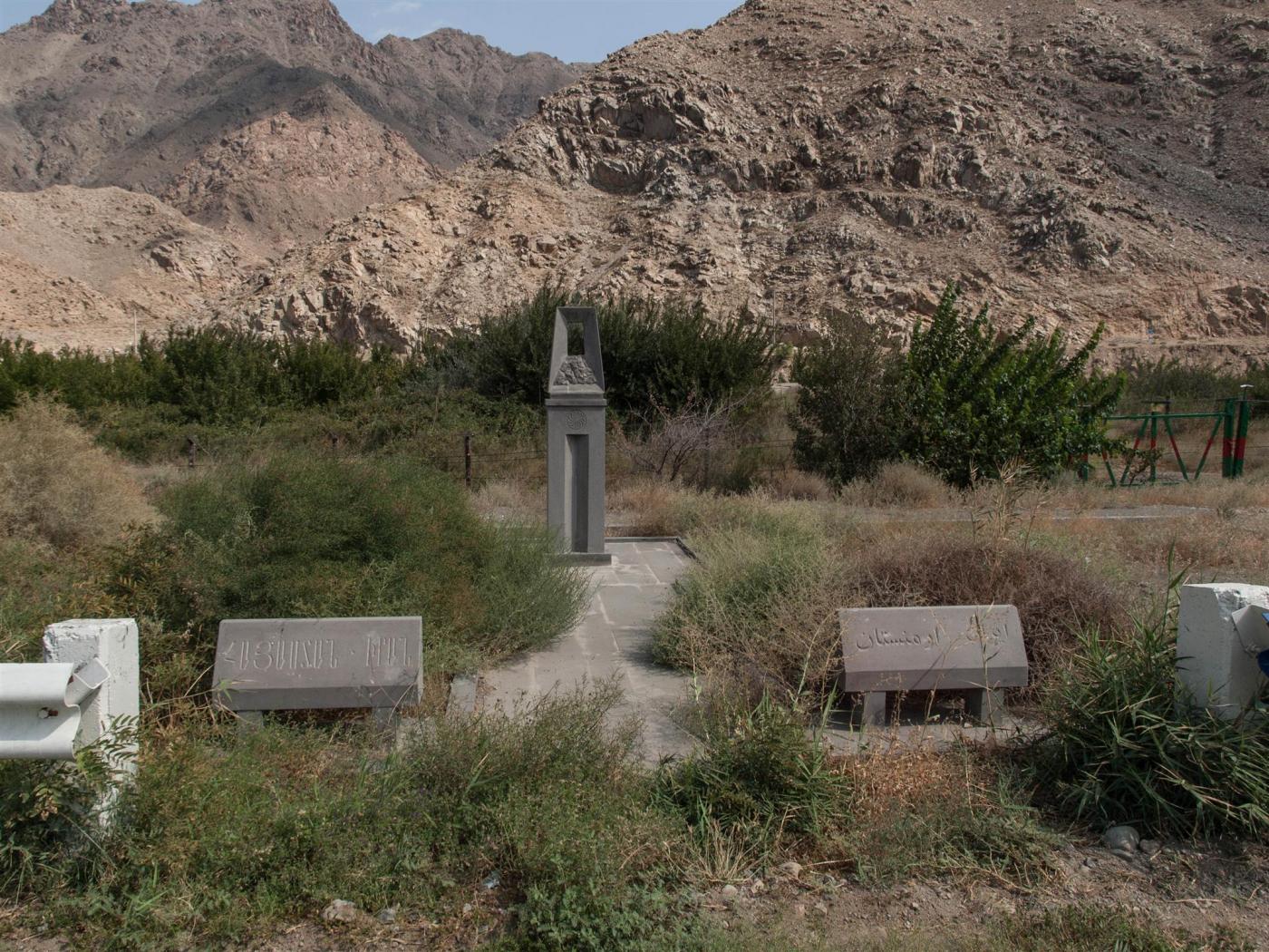
Another element that cause us intense feelings for this area, is the barbwire – perhaps even electric one – and its placed along the river marking the borders. At regular intervals, armed guards in their outposts are filling the scenery. Even some army camps we meet in our route makes a big surprise that –except the Armenian flag –a Russian flag is also standing there. As we researched after our return back home, the region is still guarded by Russian soldiers.
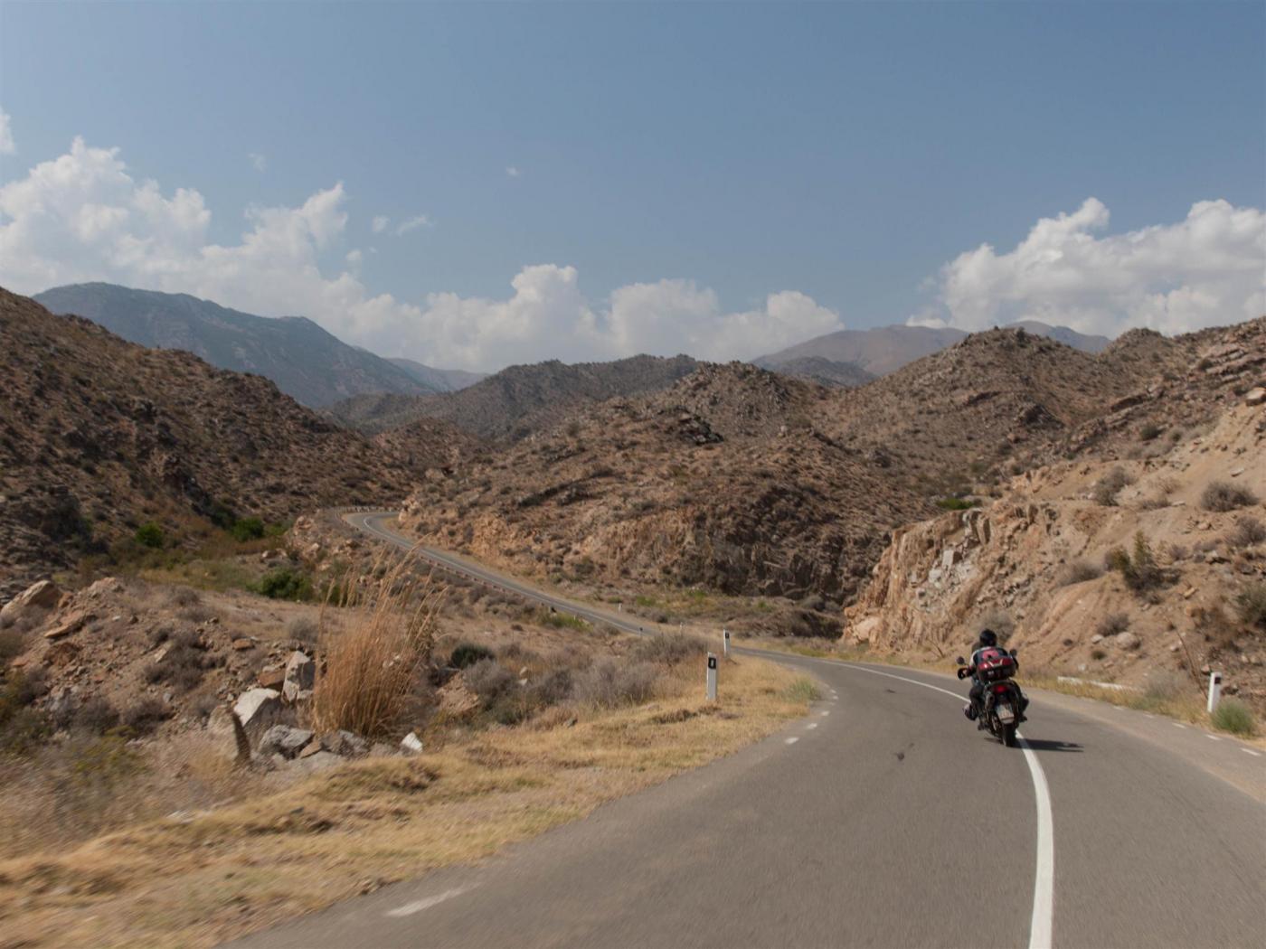
We ride with the same scenery for some kilometers, accompanied by river Aras, until the junction just before Shvanidzor village. A road sign for Yerevan leads to the M17 road which climbs the mountainous massifs of Shakhbuz (2372m), Gyumarants (2366m), Mazra (2198m) and Bartas (2186m). The road conditions are in a good shape eventhough its not a new road. The more we climb the more spectacular the view gets of the whole area. A nice cooling breeze is found just crossing 1000m in height making riding even more enjoyable.
Worth mentioning is the fact that along this route we saw no vehicles except only 1 car with Iranian plates which has stopped thinking that took the wrong way to Yerevan. No lorries, no buses, no nothing... there are some moments that we believe we took the wrong way or road. We continue climbing until the altitude of 2211 meters which is basically the point we cross the other side of the massif. A small break is done for resting and commenting what we have seen and experienced. To all of us is very peculiar the fact that this road is not used often eventhough is not a brand new one and its known to people. We reach to the conclusion that this road is longer in distance than the older one of Kapan – Meghri but as we found later on, distance difference is just 2 km. the reason that this road is not used is still unknown to us...
As soon as we start the descent we enter the wooded area (Shikahogh State Reserve) with intense vegetation similar with Meghri pass. Road conditions remain good until the village of Tsav. Further on becomes narrower. In our way we meet some villages with few houses making us feel the abandonment. After the village of Chakaten along the route we see unarmed outposts. We then realize that we are moving along the borders of Azerbaijan. As we could see, we realize there is a big dead mans land between the 2 countries...
We rode appr 200 km’s since morning, we are back to Kapan again approaching the town from another route this time. In a grocery shop, after the supposing airport – the supposing is because is totally open with no fences or guarding it – we made a pit stop to check what comes next. The issue is how to reach Tatev monastery which is among the most important ones in Armenia and its a pity to miss it due to proximity. The issue how to reach the monastery, there are 2 ways – one is via Goris (65km) and then reach the monastery (+35km). the negative part of this is the dirt road that we have to make, the same one that we met earlier today and also we have issue with time. Time is an issue because we are not familiar with the open hours of the monastery and also we don’t want to be back late to hotel because there is a possibility the restaurant to be closed at that time.
Second option is to approach the monastery from the south side via villages of Norashenik, Verin Khotanan, Agravi etc (40km) but we have no info about the road conditions. Map shows the road as a main one (H45) but we cannot trust the map because we already spotted some mistakes. We ask some locals – with the sign language of course – which ensure us that half the road is asphalt and the other half is not an issue for our motorcycles. This statement about our motorcycles makes us feel worried because we verified several times that the locals believe that our motorcycles can go anywhere we like with full load.
Processing «distance», «time» and «unknown road quality» we took the risk to continue the last option, via the south side. At the beginning was a normal countryside road with some hubs. This last for a while, maybe 5km, and then a well surfaced dirt road continues. As distance is covered the conditions are getting worst, lots of loose gravel, holes, mud, mud holes and all kinds of bad road features are found. But scenery is paying us back, landscape is just perfect. Dense vegetation with massive trees are accompanying us for the biggest part of the remaining distance.
In the very few villages we met in our route, locals are looking us with a curiosity and wondering look except the children who are looking enthusiastic about us, as in the whole Armenia. At some point asphalt is found in our route and soon after the monastery is seen in front of us.Is among the prettiest and most known monasteries of the country. Lies in a cliff and underneath the Vorotan canyon with the Vorotan river crossing it. The monastery spot is a unique location of viewing the whole area, you can observe this stunning view for hours. The monastery is dated back in the 9th century and its surrounded by a fence wall like a fort. Its architecture is the Armenian classic type which can impress someone with its majestic style and austerity. The monastery posses a big yard with a big church dedicated to apostles Peter & Paul, 2 chapels dedicated to St. Gregory the enlighten and virgin Mary, cells for the monks, tombstones, 2 fountains with running water and a hermitage.
Standing there to feel the peace that the surroundings are providing us, time here has stopped and for us as well with the result to forgot that we had to return back to Goris soon. There we met one of the few motorcyclists we met in our journey. A Croat which didn’t catch up his name, he was travelling with his Honda Transalp. Didn’t manage as well to exchange info and get to know, he came up to the monastery with a lift and he left in a rush.
Four years ago, 2010, a lift was build with the name «Wings of Tatev» carrying visitors for 5.7 km via a breathtaking route with a continues double course and by that winning a place in Guinness book of records. The lift constitutes among the most famous landmarks of Armenia and its advertized even more than the monastery. Rumors say that the airport in Goris was build for the lift.
The sun started to hide beyond the horizon and we made the decision to go. The dirt road to Goris wide but steep and it seems the reason of not making it an asphalt is because they urge visitors to take the lift. Finally found asphalt road and also reaching another point of interest which we would like to visit, the Devils Bridge. A marked path leads to a gorge and Devils bridge but the sun is down so we had to leave this visit for tomorrow. Quickly back to hotel and luckily found the restaurant open. The night passes by talking for the variety of scenery we met today fulfilling everybody with joyful and pleasant feelings, a wish was born to visit soon Iran, it was so close today for us but it was not in our plan.