We woke up without stress, as the program of that day did not provide many kilometres, and not many stops at attractions as well. Substantially we were interested on driving the TransSemenic (about 65km) and then visit the waterfalls of Bigar. Our aim was to get to the Danube town Drobeta Turnu-Severin, so the next day to be relatively close to the Calafat-Vidin passage for Bulgaria.
Around 11:30 a.m. we were leaving in the direction of the nearby lake and the Secu Semenic. The path of output passing through the old part of the city, which consisted of houses, most of which had obvious signs of neglect. From this side of the city we met some crumbling buildings and old factories. The area was near the industrial zone, nowadays, was in decline. The spectacle was filling you with thoughts about how this city could have been, when it was in her good days...
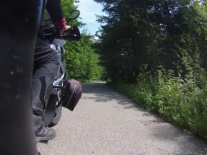
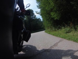
Leaving the last houses on the outskirts of Resita, essentially we entered the TransSemenic Road. From the very first kilometres, the road gave us a sample of what would follow from landscape view... The route rans through a wooded area of trees, which in many places you could not see the sky!!! The branches formed some naturally tunnels! The road conditions were not the best, in relation to what I had read and heard about this road. This lasted only a few kilometres at the begining.
Soon we were at the intersection of Casa Baraj, point that on the map depicted as a lake, and so we decided to take a look. The Casa Baraj is a lake created by a dam located on the edge. Around the are small and thoughtful tourist facilities operating mostly in the summer, as we met wooden platforms with sun beds for bathers. We met a camping and 3-4 accommodations, in a pretty good quality. Around the lake there were broad-leaved trees, which were so thick, I had to look to find an opening in order to be able to photograph the lake. To be honest all this under other conditions it would have seemed normal to me, but having in mind the image and feeling that neighbouring Resita creates to you, their presence seemed hopeless. We stopped to take some photos and dropped the idea to drink a coffee in one of the lakeside cafes.
But soon we abandoned this scenario as we thought better to drink our coffee somewhere higher and more "natural". We returned to the previous intersection and continued our way climbing altitude, while the condition of the road was most amazing! Comfortable corners making our driving enjoyable. The vegetation is increasingly rising, impressing us even more! At some point we met a woodwork from which it was running water from a source. It was the perfect place to stop for our impromptu coffee. We prepared it in bottles that we had and we put in the water to freeze. Really enjoyed both our coffee, and the landscape. After a while other drivers stopped to fill bottles with water, dissolving every doubt about whether it was ok to drink it.
We sat for a while, until we decided to depart for the rest of our way. After 10km we arrived at the highest point of the route in 1000, which wa marking the passage to the other side of Mount Semenic. Along the way we met 2-3 villages, where you could see a development effort. Going down we met places where there were free campers. After the passing and for a few kilometres the vegetation decreased slightly.
Along the way we met the lake Lacul Trei Ape, as this lake is created by the three rivers. Around the lake there was free campers again! Truly one of the things that I like about Romanians, is their love of nature, regardless that unfortunately you come across several garbage...
Continuing to Slatina-Timis, we got back together in a dense vegetation natural environment, where one river was keeping company to us for the last 10 km of the route.
The TransSemenic (DN175), is another driving pleasure of Romania. It may not offer the high altitudes of TransFagarasan Road and Transalpina Road with incredible views, however in terms of the natural landscape, standing worthy of expectations! The reconstruction was completed in 2012-2013 with EU funds. Previously the situation was bad, and in many places was paved. Its visited by many cyclists as well. A favorite destination of motorcyclists local and foreign. Correctly -in my point of view it is inside the 4 best Romanian routes. The name comes from Mount Semenic, which crosses it.
The Slatina-Timis marks the end of TransSemenic and located on the axis Carasebes - Orsova. We continued to march south and we felt after several days the discomfort of the heat and the presence of several trucks made it difficult to drive enough. About 30 km before Orsova came across the sign for the waterfall Bigar Cascada (56km). To be honest I thought it would be shorter the distance from the axes were moving, but we were so determined to visit him, that we did not care about the further 120km.
So we turned, left and continued in a more intimate way, but in good condition and mostly in a beautiful landscape. Guided by the signs for Bozovici, we crossed several villages, most of them poorly. The Bozovici was quite large and different from the rest. Shortly after, the road was going again in a wooded area that looked like a small canyon, in the base of which was the river Minis running, alongside the road.
After a few kilometers we arrived at the entrance of the waterfall Bigar, at which point was passing the 45th parallel of Earth. Several cars were parked, indicating that attracts many visitors. To enter you pay 5RON. Certainly not a few people jump the fence right next to the front entrance infront of the employee eyes (!), In order to reach the waterfall, descending a steep path. At first it seemed bad to me, but then I gave them a right...
Upon entering the site, you cross a wooden bridge under which is the waterfall and the river Minis. To get up there you descend a staircase(!), without stairs, but what has been formed from the earth. To get to the waterfall photography, you have to find the hallway from stones to cross the river, which is not so shallow in some places, and to find yourself near the waterfall you have to find a personal path in the rock. There is not so tragic, but by the time they have put ticket, ae least they should have some rudimentary infrastructure... otherwise leave it free and to its fate...
Beyond the grotesque, cataracts impressed me and if I had not seen it in photos, I would be even more impressed! A vaulted green rock creates a circular cataract like water running from umbrella! I sat long enough for the photograph and enjoy the spectacle! Then we wanted to visit the cave of the area... There was many patents! Two beams play the role of bridge and a staircase like the ones we climb on walls, they had it at an angle in order the visitors could climb a slope of stones! To reach at the entrance of the cave, you climb a rock with the help of a lifeline... Almost climbing! It seemed funny to us, but at the same time I was thinking that a serious accident could happen. The cave was not something special, as it was possible to see only the entrance via an additional climbing. In any case it was worth the visit.
At 5pm we returned to the bikes and took the way back, just as we had come. There was an alternative scenario to go Ovorita or Moldova Noua to follow Danube route but it would load us up with several additional kilometers -and delay us in time due to truck traffic. Moreover we had already driven the Danube route in 2011. We returned to the shaft Carasebes - Orsova in about 30 minutes and soon found ourselves in Orsova, facing the majestic Danube once again after 4 years! You can see him many times, but always causes you awe with its size!
Following the riverside path, we passed the bridge that connects the two neighbouring countries, Romania and Serbia and continued further to the city Drobeta Turnu-Severin that I was visiting for the first time.
The danubian city has a parallel layout outside the historic center of which is a large square and some streets around. Most houses are detached houses - villas, especially in the central area where we found accommodation. From the little we drove to it, I think you can move around it comfortable, but beyond that I can not say many other things.
The city was established near the ancient Roman castle. Since antiquity was perceived important strategic position, since it was the crossroad of the east to the west side of the Danube and controls the passage. The city is built on the left bank of the river which forms the border with Serbia, where the Portile de Fier (=Iron Gates) finish. From Bucuresti is about 340 km. During the Roman Period is known as "Drobeta". In the era of Trajan was built the longest bridge of the empire, by the architect Apollodorus of Damascus. Had length 1.135m., width 14,5m. and height 18,6m. in a series of 20 arches and connecting the two banks of the Danube.
Before 2-3 days randomly looking at booking I found Pensiunea Ambiental (32euro / double), which was economic and had good reviews. I noted the address. Searching, we asked random 1 hotel found in front of us and filled our eye, but it was full. We decided to try our luck in this pensiune and we were lucky. It was decent, clean, economical and had a parking area.
We arranged our things and we moored in the lobby, smoking and talking. With the conversation the time passed so we thought to order food delivery from some brochures I had seen. A nice girl made our order and eventually we stayed in guesthouse.
The discussion lasted until late into analyzing the trip, what we had seen, the roads we drove, everything that had changed since my previous visits... For some strange reason, I found, that Stratos has a particular liking and preference for the country...even if he have not lived six years here as a student... Objectively is a beautiful place, definitely the best of the Balkan Peninsula and not only...


