From Ararat to Van Lake
Early in the morning we went to the hotel's top floor where breakfast been served. Although the previous day was a difficult day, and in a way, we were starting our return route to home, we were in very nice mood and we had passion to continue our exploration. We did our last jokes and change some information with our Italian friend and then we load our motorcycles with our baggage.
The area around the hotel has a very different view under the day light. Everywhere there were small shops that had put their products on benches in the sidewalks and a lot of people moved between benches. Most of the women have covered their heads with a scarf, they trying to have a glance as they were passing close to us. There were few people who had left their jobs and had come to us to watch the departure preparation process of the modern caravan.
The hotel owner, who was making remarks to his employees during the morning, has come to the hotel entrance and monitors quirky customers, eager to serve. Also he had decorate the reception with a Greek flag...
Before the separation with Italian friend, Manolis asked him to say a few words in camera, in order to use it for our memorial video of our little adventure. Gigi accepted with joy. The follow are some of his words: "... the meeting with the team of Greeks happened by accident to Ani, in a so beautiful place that helps you to renew yourself... But this time after this meeting it was not renewing what we felt,it was as we have reborn... "
We take one last group photo and we invited him to come to Greece to view the presentation of our travel. After that he moved north and we south taking opposite roads...
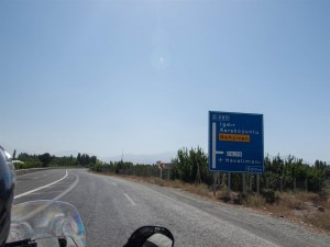
We left Kars with destination to Igdir. The route passes through an area lacking vegetation. The arid highland is inhospitable and you wonder how can people live in the small villages we met there. In most cases this villages are connecting to the main road through dirt roads. Dotted there are some plates informing that there are «kilise», means churches. This area is very close to the border with Armenia and in the past it was part of the Armenian state. The half-ruined churches stand now, remnants of that memory.
We were looking for gas station for a long time. In the only gas station we had met there was only oil. The gas alarm in Triumph had fired and travel control shown reverse kilometers counting, but there were not any gas station on the road so we decide to enter to the city Tuzluca where according to GPS there were a gas station. We found it when the Triumph travel control gave estimation for more 7 km. Finally when Stelios full, understand that that he was were 1,5lt gasoline inside tank, before the full up ...
We continued with destination the city of Igdir, where we found the node that drives to the state of Nakhchivan (Nakhichevan). As we have said earlier, this state is part of Azerbaijan but bordering with Armenia, Iran and Turkey and has no border with main Azerbaijan. The border line with Turkey is very short, like a strip of land. At that point, there is Araxos (Aras) river, and the bridge crossing the river named "Freedom Bridge".
After Igdir, we show from Turkey side, for first time the top of the biblical mountain Ararat. We were very luck, as we had the change to sow the snowy top without fog and clouds! Something that is very seldom as most of times top is covered by clouds, as it had happens when we were in the monastery Khor Virap few days ago.
The landscape was same as before. The road climbs and the elevation reaching at 1680m with destination to the Dogubayazit. As we had approached the foothills of the mountain, we made a short stop to admire the view. The Mount Ararat is located on Turkish side, but still it is the most important mountain for Armenians and Iranians. Ararat Mountain is 5.137m height and is the highest in Turkey. According to the Bible is the place where Noah's Ark aground after the Flood. There are trekking agencies who arranges Mountaineering (simple or more difficult) with guides and overnight on the mountain. The Italian we met yesterday had climbed on the top...
Following the downhill road to Dogubayazit, soon we were on the plateau which hosts the most important city in the eastern border of the country. It is a station for a huge number of trucks which moving from / to Europe. This focal point has a long history, as it is located on the ancient trade routes. At the entrance we had met many road works. They have started the construction of interchanges in the main road connecting borders with Ankara. On these conditions there were not clear the traffic rules and the traffic condition was a real panic. Wanted to visit the Ishak Pasha Saray, we pass through the town center.
The feeling we get of this city where that it was created in order to sustain the population near to the borders of the country. In general there weren’t some kind of architecture in the buildings. The apartment buildings have built along a commercial street with many small crowded shops. Everything is located around there, reminding strongly neighborhoods with social houses. Following a paved road we arrived to the imposing saray of Ishak Pasha. It is located in a location with amazing view, at the edge of a rock.
It had been constructed by sandstone rocks by an Ottoman governor. It combines different styles (Ottoman, Persian, Armenian, Georgian and Seljuks), something that make hard to calculate the age of this construction. Saray located on the Silk Road, the location explains the fact that it has built such a luxurious building on the edge of nowhere. It has 336 rooms that include harem, 14 bedrooms, a mausoleum, an events and ceremonies room and a small mosque. Unfortunately, the day we had visited was Monday, and it was closed to the public. In any case, the grandeur and elegance of the Saray are perceived.
We left the saray and after a failed attempt to have a coffee in nearby cafes, we moved again through Dogubayazit and we followed the road to Ankara. Covering a few kilometers, we were on the hub for the Van Lake and the homonymous city. This route crosses an area with volcanic rocks at an altitude of 2600m. The face was such as it had been by lava that had just frozen! Responsible for the scenery is volcano Tendurek inactive since 1855.
At some point, we met a group of kids and "alarm bells". Generally we observe that when there were many boys together there were trying to sow their courage showing an aggressive attitude to us by throwing to us staff like wood, stone, or whatever else was in the area. Fortunately, this was the minority of cases, as most children shown joy and excitement when showing us...
But the specific threat us by waving a large wooden stick. Manolis with George that moved ahead avoid them, as they did not have time to regroup. Next in the series were I, the gang jumped in the middle of the road, almost in front of me. I start shouting and I turned the wheel of the bike straight at them, in order to scare them. The trick was effective, gang regressed, I speed up and avoided then. As I looked from my mirror, I sow the stick be directed to Stratos who was the last in convoy... Fortunately, that "good guys" failed...
We continued to move quickly, enjoying the scenery, in an empty and very sparsely populated road with few vehicles moved on it. The rout at some point approaching too close to the Iranian border, this is confirmed by the outposts that exist on the mountainside. One more time was difficult to find a tree in order to make a break under shadow. We had to drive for several miles until the village Gonderme, where finally we show 3-4 trees close to a runlet. As expected we stopped there and lie down on few grass.
After we had make and drink an instant coffee and eat a snack we continue to Muradiye. Just passing it we could saw in front us the Lake Van. It is the largest lake in Turkey, with length 119 km. (7 times bigger than that of Geneva) and with max depth 450m. The lake is situated at an altitude of 1640m., it was created by numerous small streams that started from the surround mountains. It is said that the water is so alkaline so the residents do not need shoap to wash their clothes.
This huge lake could not have its own monster. There are old references for «Van Golu Canavari» or simply the "Monster of Lake Van», but just in 1997 was released an amateur video cached by a young man. Soon the news was released and since then more than 1000 people have said they have come face-to-face with the monster, which has the same characteristics as the Scottish living in Loch Ness: 15 meters long with hump which usually distinguished above from the water level. Are you think that is there any possibility to be relatives?
We continue our way with destination the city of Van, which situated on the eastern side of the lake. In most parts of the route, we had views of the lake, while in others parts we passed a bit away from the coast, going up and down on small hills located around the lake.
In the afternoon we reached at the largest city of the lake, the city of Van, which is known for the homonymous cat. In the main square you can see a huge Van cat statue, which is the symbol of the city. After a short stop to refuel, we took the road to Tatvan and especially to the village Gevas. There are some campings or at least something considered as camping.
We direct to the Akdamar camping which is proposed by the Lonely Planet. Basically it is a tavern on the main road, directly opposite the dock where departure the boats for the lakes island. As soon as we parked the bikes the owner came with joy to welcome us. Stratos and Natasha went to check the place and after some time they return with not-so-good news. The true was that the place has nothing to do with a camping, there was same space, very close to the tables, in an edge of the tavern garden, which was available for the tends and it was out of charge! The noise from the main road and the fact that the place was not so clear combined with the bad condition of the toilets drive us with no more time loss to reject this option. The funny thing was that as we had got our decision and preparing to depart, the owner makes a desperate attempt to convince us, ordering the tie wearing waiters to collect garbage spread in the area close to the place we had parked, also the owner exclaiming us that his place is suggested in Lonely Planet.
We continue with destination the city of Van, as we had seen and ignore same plates informs for camping places. A little further we find the Avasin camping. It is a place with few grass and some tables, some of which is under kiosk. The owner proposed us to stay all of us with a cost of 30 Turkish liras. The place is not something special but it was definitely better than the previous and since the sun has begun to get, we take the decision to stay there.
Manolis with Natasha went to find something for food and we stay in the camping to set up our tents. They was lucky as they discover a kebab restaurant 100 meters away from the campsite which is open during the night. After we had set up our tents, we move on it. The tavern has some cooked and some grilled foods which of course are all spicy. We test "one of everything" from the menu and return to our tents to enjoy the almost full moon reflected in the lakes water...


